Saturday, 5 June 2010

Raynes Park and the Mysterious Electrical Item

If proof were needed that driving around is no way to see your neighbourhood, this particular item is as good an example as any. It's located at a hectic cross-roads just before the busy A3 and I must have driven passed it hundreds of times over the years. It was only when I went past on foot the other week though that I actually noticed and then when I did see it I was left wondering how on earth I never saw it before! To be fair though, it is set back from the kerb, painted green and sited against a backdrop of trees and bushes which is probably how it's managed to survive so long...
The question is of course, what is it?  With all the 'classic' mouldings around the base, it  looks as though it's an old lampost but the fact that there's a door at the front at it's base would suggest  that it was always intended to have a more significant role. The two boxes on the side also suggest that the whole contraption was  a bit on the 'Heath Robinson' side, with sections being added as required.

Discounting the possibility of being a lampost, what else might it have been? I did wonder if it might have been a traffic light of some sort but it's distance from the road makes that unlikely. Could it have been the control box for early sets of traffic lights though? An early  switchboard box maybe?

I haven't really got much of a clue about this one so I took a number of photos in the hope that someone might be able to help out.
 Side view - showing distance from the road

There's a large box of tricks next to our post. Could it be it's modern equivalent or is it something unrelated like a telephone exchange?

Acme Lighting & Engineering Co.
Waverley Road, St Albans

I was hoping that this would provide some information but I've not been able to find out much about this company at all. There have been a number of mainly engineering companies under the Acme name in Waverley Road but the lighting branch has been a bit elusive to date.
The remains of the old heavy duty wires are clearly visible as is the wooden backing board, along with a bit of rust and a few cobwebs.

Presumably there was originally a door on the front of this section which covered up the vertical pipe coming up from under the pavement
A closer look reveals some three-core cable and the remains of some insulation. Possibly a fuseboard of some sort?

Pipes going in, coming out, going to boxes, going down pipes and all the time looking like an old-school cyberman's head from the BBC
The views below take in the larger of the two side boxes. Again not much to see and one of the hinges has been broken


And finally at the top of the post there's what looks like a cap. Originally painted white it has three side screws - presumably to hold it in place - and a final screw on the top. Was it always on the top or was it put on when (presumably) the top assembly was removed?
I'll be dropping some emails to other specialist sites to see if they can identify this but if you've any ideas please feel free to leave a comment.

Friday, 21 May 2010

The Greenwich Burton Bags A Brace

Some time ago I came across the phenomena of the Burton's commemorative granite plaque. This item was to be found wherever Montague Burton opened a branch of his gentleman's Tailor's and for some reason always seemed to be laid by a member of his direct family. I was so intrigued by this I even wrote about the practice on this blog . I had originally found plaques laid by Lady Montague Burton and her sons Arnold & Stanley and ended it with the prophetic words
I hope to find some inscriptions from Barbara and Raymond as well as from Montague himself in order to complete the set and with over 600 potential sites I'm sure it won't take too long.
Well last week, on the way back from the Greenwich Observatory, I hit the jackpot. Not quite the full house but getting there as I bagged both Barbara and Raymond to add to the tally. *

Of course it was pure luck, as these things often are and it was only when the distinctive Scottish granite caught my eye that I realised the coffee shop on the corner was actually an ex-Burton's. I was pleased to spot first one, then a second plaque but also had the bonus of a very attractive floor mosaic as well.
That seemed to be good enough but after crossing the road and heading toward the railway station I realised that the old shop had extended around the corner and that there was yet another plaque and mosaic needing recording. Over I went for another quick look and another photo...

For those in the area the shop lies on the corner of Nelson Road and Greenwich High Road and it's nice to see that these particular memorials have been left undisturbed and in place. With Barbara and Raymond I think all I need is one from Montague himself and I'll have the full set!

Raymond was one of the Burton twins, along with brother Arnold
Barbara was the only Burton daughter
 The two entrance mosaics, one in each street. I suppose these would be regarded as late examples of the shop mosaic art but I find them quite attractive in their own way. I particularly like the design of the  'O' in 'Tailor Of Taste' - but then I'm easily pleased...

*Of course having checked back on my original post I now notice that Sebastien Ardouin actually mentions these mosaics and plaques in the comments section. Still, they don't really count in the 'Faded London' universe until I spot them myself and as I came across them unintentionally I can put this down to fate and a happy coincidence rather than the chasing up of a kind lead!

While I had the camera out this old painted street sign also caught my eye. There are quite a few of these about but they still seem worthy of recording. I might well collect enough to make a posting about them but until then here is the Prince of Orange Lane acting as a trailer for the main event...

Monday, 17 May 2010

The' Ghost Sign' Bakery of South Wimbledon

As they are usually there in an advertising capacity, it's not often that you come across ghost signs in back streets as the number of passers-by doesn't really warrant the expense. However every now and then one does pop up, not as an advert but as a company name. I think this is the case with this frustratingly incomplete ghost sign I spotted the other week. Kirkley Road is a small residential street in the south of Wimbledon that leads onto the busy Kingston Road and pretty much the last thing I expected to see as I turned into it from Shelton Road was an intriguing old building with the remains of its signage still visible.

It's set just back off of the road and the address gives a bit of a clue as to what it might have been used for, namely The Bakery, 2A Kirkley Road. With that in mind you can just make out the word Bakers or Bakery in the top right. The other words are beyond me though: I thought The first word might have ended  -ing and that the presumed name of the Bakers might start with  KIT or even KING. It also looks as though there might be several layers of paint involved which doesn't help trying to work it out


I couldn't find much in the way to help on line for bakeries in Kirkley Road so I visited the local library to have a look at a few of the trade directories. Again not much luck until I started looking for bakeries on Kingston Road. It occurred to me that it was more than likely that the bakery was the 'behind the scenes' section of a high street shop, and as soon as I worked out roughly what number on the Kingston Road the premises would occupy then I had a few results.

92 Kingston Road seems to have been a bakery for many years, with several changes in ownership. The ones I spotted in the local Kelly's Directories were

1926             George Harrington,                     Baker
1938             Fred[eric]k, H[enr]y Martin          Baker
1940             A. H. Edwards (Caterers Ltd.)   Bakers

None of these names fit easily with the ghost sign, although I am sure that a bit more research would through up some other, later owners.It does however suggest Catering might be the first word though, making a top line of Catering Bakers a possibility. Not being too old a sign may help in the search of its origins as well so fingers crossed that someone might have some more thoughts on this one. The shop at the front is no longer a bakers but now deals with staffing for social care workers but that also looks a fairly recent transformation. So, who were the mystery bakers of South Wimbledon???

And whilst on the subject of Kirkley Road...

"Graphic Stories of Heroism & Narrow Escapes" - Wimbledon & Merton News August 23  1940
As a slight digression, one thing that came up when looking for information on the bakery was the actual position where I had stood to take some pictures! This was basically at the junction of Kirkley Road and Shelton Road and would definitely NOT have been a good place to stand on 16th August 1940 as it was the exact site where a German bomb fell in the early days of the blitz. 
According to Norman Plastow's book Safe As Houses - Wimbledon at War 1939-45 the bombs were relatively small 50kg High Explosive bombs but they caused a great deal of damage and the loss of 14 killed and 59 injured in the surrounding streets. I had a look in the local papers of the time to find the headline 'Suburbs Bombed in Nazi Attempt to Raid London - Crowd Caught In Streets During Rush Hour' . Not surprisingly no specific streets or individuals are mentioned in the newspaper coverage but it does make for interesting reading. Whether or not anyone was hurt by the Kirkley Road bomb I couldn't say but I've no doubt  the bakery would have been badly shaken up by it.


(ADDENDUM: Some interesting comments on this one and thanks for those that made them. Sebastien Ardouin has identified the top line of text as being 'Hygienic Bakery' and he certainly looks to be spot on with that one. He has an interesting article on them as well.

With regard to the August 16th raid, Duncan has pointed out that there was a picture on flicker of the bomb damage in a neighbouring street taken after the raid which is also very interesting.)

Wednesday, 12 May 2010

Tooting's Well

If you were to take a stroll up Mitcham Road from Tooting it wouldn't be long before you saw an intriguing item on the pavement on the corner with Church Road. It's not a statue, or an obvious piece of sculpture - in fact it looks a little like a drain stink-pipe crossed with a broken village clock tower - but it is, in fact a commemorative marker. What it marks is the position of Tooting's very first publicly owned artesian well!
I don't really know much about wells and, interesting as it might be, I wasn't really all that sure why having a well was worthy of such a memorial.  If it came to that I wasn't really sure what the difference was between an artesian and any other sort of well*, so I thought I'd see what I could find out about the subject in general and Tooting's wells in particular.

First off there was the question of geology - how deep did the well have to go and what did they have to drill through? I found the answer in a most unexpected place, the Edinburgh Medical and Surgical Journal, Volume 71 which seemed to have quite a lot of information about the geology of Tooting. This describes the process of boring a well just up the road but I assume it's a pretty good indicator of the task faced by the locals at that time.


Edinburgh medical and surgical journal, Volume 71 1849

To put this into some sort of perspective Richmond Bridge over the Thames is 280ft long, so stand that on end and that's how far down the residents of Tooting had to go to get some fresh water!
That Tooting was short of water must have been bad enough, but the fact that the neighbouring village of Streatham had water in abundance must have rubbed salt in the wound somewhat as they seemed to have more than enough for their needs, even becoming something of a tourist attraction as a result. Wikipedia notes that

The village [of Streatham] remained largely unchanged until the 18th century, when the village's natural springs, known as Streatham Wells, were first celebrated for their health giving properties. The reputation of the spa, and improved turnpike roads, attracted wealthy City of London merchants and others to lay out their country residences in Streatham.

Streatham's spa supply actually failed in 1792 but faced with ruin a new source was 'discovered' near by and seems to have slowed down the decline for some time after, even into the 20th century. According to some reports you could still get a bottle of Streatham water pretty much up to the First World War                                                    It is curious to note that while several spas near London have disappeared, that at Streatham still exists at the end of Wells Lane, now Well-Field Road, and the water is sold in bottles on the spot and delivered to town daily.
                                                                          Memorials of old Surrey John Charles Cox - 1911
Even as late as 1885 with both Tooting and Streatham beginning to grow appreciably in size and population the issue of water could be a source of friction between them, as seemed to be the case when a
... meeting [was] held in reference to the Southwark and  Vauxhall Water Company who are sinking a great well at Streatham which has had the effect of abstracting the water from upwards of one hundred private springs and wells in the parish of Tooting...
Journal of Forestry - 1885

I'm not sure what the final outcome was but I suspect the Streatham pump would have had to be limited in some way. Shades of a South London Manon des Sources!

However in the early 19th century, back in the small village of Tooting, it was obviously bad news that such a significant  resource as water was in the hand of a few individuals, and so the decision was made to break the monopoly, even if one of these wells, the property of a local apothecary, seems to have been an object of some wonder... Apparently it came up with such force that it gushed like a fountain to the height of a couple of storeys and presumably provided a very useful alternative source of income for the lucky owner!


Without looking through musty old documents and contracts of the period, you might never think it possible to find out much about the individual who actually dug the bore, but through the marvels of the internet I soon came across an important clue                                                                                                                    

The Mechanics Magazine of 1824 published an indignant letter from the very man who had dug the well at the 'coach-road side at Tooting'. This is significant as the memorial to the well is opposite The Mitre Hotel, a famous coaching inn that still has its stable block to the rear. It also ties in very nicely with the date given for the construction of the monument, 1823. He was apparently rather miffed that someone else was trying to pass off his work as their own...             
 John Goode was a professional well-borer with several patents to his name. He specialised in the London area but also went out at least as far as to Chelmsford in Essex. He obviously did a good job in Tooting and was presumably well-paid for his efforts.

There was also a helpful diagram  showing the rough strata of the London area that John Goode had to deal with and this was pretty much a clay basin with a chalk sub-strata. This chalk was the source of the purest and softest water and it was its sponge-like characteristic that was able to provide sufficient pressure to force water up the lucky apothecaries bore pipe.  Now however, thanks to their finance and John Goode's efforts the good people of Tooting were able to drink their fill at their own Parish Pump well. They were independent with a high quality water source filtered by huge chalk beds, and an occasion definitely worth raising a monument !

(*An artesian well is apparently one that does not require pumping, but which forces water up the bore tube on its own. Mostly this happens when the water level is suppressed by something like a layer of clay. When that 'cap' is pierced the water shoots up to find its natural level. So now we know...)


Monday, 26 April 2010

Holly, Croquet and The Berrylands Dairy

It's funny how sometimes good can come out of a bad situation. Not that this was particularly bad, but one evening last week I was supposed to be at the grand opening of my niece's Headmasters hairdressing salon in Surbiton and my quick internet address check had thrown me a curve-ball. What I assumed was the salon address actually turned out to be the Headmasters Head Office and whilst an obliging member of staff was kindly finding out where I was actually supposed to be, I had a chance for a quick look around the immediate area. Which was very fortunate because this caught my eye on the other side of the road...
The archway fronts onto Ewell Road and is in the middle of what looks like a lateish-Victorian building. Not that I'm any great judge of these things but the 'established' date of 1840 looks well on the early side for the building to me. The cobbled path beneath the arch winds back to what once must have been a fairly substantial, prosperous and busy dairy yard, if the quality of the archway can be taken as any indicator.

Berrylands itself lies between Surbiton and the A3 and intrigued by such a self-confident and solid  inscription in what seemed to be a fairly insignificant area, I thought I'd do a little digging around to see if I could throw any light on the history of the dairy itself.

I soon found out that most of the area that now makes up Berrylands used to be farm land  and according to to one source there were two farms, Berry Lodge Farm and Berrylands Farm. However according to the Kingston Borough website, there was actually just the one, originally Berry Lodge Farm but which later changed its name to Berrylands, just to confuse everyone! This farm was a significant and ancient building and was even noted in the 1911 edition of A History of the County of Surrey: Volume 3 
The only house in the district covered by the modern Surbiton marked on the maps of the 18th century was Berrylands Farm. It certainly existed in 1736 and is probably much older..
The significance of this farm for both the dairy and the surrounding area is that it seems to have had a large dairy herd pretty much dedicated to supplying the rapidly expanding area of Surbiton. Whether the arrival of the railways also meant that there was the opportunity to send milk into the heart of London as well I couldn't say but I'd be very surprised if the dairy wasn't owned by the farm owner as well. After all if you've a monopoly on a local product I couldn't see why you'd let a middle-man in to 'cream off' some of the profit.

Following up on the dairy theme there's a small snippet in the Livestock Journal of 1922 that would suggest that the milk (and good quality stuff at that) was still flowing freely at that particular time
HOLLY, W. & SONS, BERRYLANDS, SURBITON. Registered herd, Pedigree heavy milkers. Societies milk records, tuberculin tested. Stock bull (Stagenhoe Governor) has won several first prizes, Champion Cup at Reading, also Silver Medal Dairy Show 1920; also numerous prize-winners, including first for best heifer, second in Milking Trials and Silver Medal at London...
There's another entry in the Agricultural Gazette of the same year which remarks on the quality of 'Tolworth Lassie' another of the Holly families prize-winners, as being a 'wealthy type of heifer, remarkably well-grown and showing promise'.

It also seems that the dairy building wasn't the original one, as I suspected. There's a Kingston document regarding the nearby Fishponds Conservation area which is illustrated with a number of maps. This clearly shows that the  dairy building wasn't there in the 1880's but may have been by 1896. It's not too clear to be honest, but what is clear from the old maps is the increased population bought about by the arrival of the railways in the 1840's, which just so happens to be when the dairy was founded.

As time went on the dairy land was supplanted by further building and even a few sporting facilities as the following note in the records of the Surbiton Croquet Club archives of 1911 indicates - "The Hon. Secretary reported ... that Mrs Stevenson had applied for a croquet section of the club to be formed and additional lawns laid down on the land adjoining the club forming part of Berrylands Farm."

Even up to 1939 the Holly family seem to still have been a force in the club as in that year records note that the  "... prizes will be presented by Mrs W Holly (president)." Sadly she died later that year in her 70s and I would imagine that that and the post war building boom might well have been the catalyst for the final break up and sale of the remaining land and whatever remained of the dairy herd itself.

One last little mystery caught my attention, and that was the fairly plain mosaic in the shop front to the left of the arch. I imagine at some point that this could well have been the dairy shop but sad to say I can't be sure because whatever name in the middle was originally, it's been very thoroughly erased by later owners!
(Before I forget - if you find yourselves in Surbiton in need of a new hairstyle try the new Headmasters opposite the station. If I still had any hair worth dressing I'd be there like a flash!)

Thursday, 1 April 2010

Belgrave Square And The 'Ghost Signs Archive' Launch

March 18th saw the launch of a wonderful collaborative archive between Sam 'Ghostsigns' Taylor and the History of Advertising Trust . Basically Sam has been working hard to establish a national photographic database to provide a record of this unique form of advertising and the launch took place in the IPA building in Belgrave Square. Sam very kindly invited those who had contributed to the archive along for the opening and being a sucker for both Ghost Signs and a free glass of wine, Faded London was more than happy to join in with the celebrations.

Never having knowingly visited Belgrave Square, and not being one to miss an opportunity, I took a quick spin around the block in the closing gloom before making my dazzling entrance at the launch party. There were a couple of interesting items as well, not least of all this water trough at the top of Grosvenor Crescent. 
It's part of an edifice that serves as frontage to a building that was originally St George's Hospital prior to its relocation to Tooting. It's now the Lanesborough Hotel and has been scrubbed up a bit.  I found this detailing on an Images of England English Heritage site and am pleased I did as it throws a little more light on the organization responsible for all those granite cattle troughs dotted around the capital
Attached drinking fountain on Knightsbridge façade. Inscribed "MDCCCLX" (1860) on the frieze. Erected by the Metropolitan Drinking Fountain and Cattle trough Association. Fluted shell basin of carved stone on a rough stone base flanked by stepped plinths surmounted by acanthus leaf consoles carrying a frieze and cornice with scrolled pediment and central finial. One of the earliest drinking fountains erected by the Association, a hospital being seen as an appropriate location. Founded in 1859 The Metropolitan Free Drinking Fountain Association (Cattle Trough added 1867) provided free fresh water to many humans and beasts at a time when ale and spirits were easier to obtain than water and most supplies contaminated. 
There would originally have been cups attached to chains for the ease of drinkers, but these have long since either been removed or broken off.

Continuing around the square and tucked around the back is the Norwegian Embassy building. Either side of the Front door are these two small but interesting friezes showing cherubs engaged in what I assumed at first must be typically Norwegian activities.
A bit of art going on in this one with some painting and sculpture along with what looks like some architectural consultation judging from the stonework lying about the place.
 The other side stays in the country with its rural theme of shepherding, growing crops and taking some time out for a tune on the pan-pipes. There was a plaque explaining some of their history
In 1796 these two coade stone reliefs were affixed to the Danish-Norwegian consulate in Wellclose Square Stepney. In 1968 the reliefs were re-erected on this embassy by courtesy of the Greater London Council
 In know what you're wondering... 'what's coade stone?' Wikipedia has the answer, of course
Coade stone was a ceramic material that has been described as an artificial stone. It was first created by Mrs Eleanor Coade (Elinor Coade, 1733–1821), and sold commercially from 1769 to 1833. 
So it looks as though the date of 1796 puts it right in the middle of the production period and it's not as if there are lots of them about as there are only about 650 known surviving pieces. Apparently lots of decorative designs were sold 'off the shelf'  so there's a good chance that they're generic cherubs and not even been produced with Norway in mind! 

Having exhausted the square I finally arrived at the launch party and was very pleased indeed to make the acquaintance (and the re-acquaintance) of several other bloggers, as well as enjoying the speeches and the presentations. Unfortunately I was so eager to get at the wine and crisps that I left my camera in my coat pocket and only managed to get one shot of the event just as I was leaving.
Quite a cunning one as it happens as I managed to bag Sebastien Ardouin of Painted Signs and Mosaics and Caroline of Caroline's Miscellany in the foreground whilst Sam Roberts'  head is neatly framed in the background, just underneath one of the slides.  The evening was a great success and full details of the launch and the archive itself can be found on it's new searchable website. Well done to Sam for all the hard work he's put in over the last year!

But the evening wasn't yet over. After making my excuses and disappearing silently into the swirling London mist I caught sight of an intriguing coal-hole cover and managed to get a reasonably clear picture. The inscription reads "Luxfer Prisms 46 Hill Street London EC"
Luxfer Prisms were a company better known for their glass cellar lighting panels rather than their coalholes and previous examples I've seen would have had glass inserts instead of holes, which would have been more in line with their core business. Glassian is the place to go to find out more about the company and one interesting comment is the origins of the word LUXFER being  'from the Latin words lux (light) and ferre (to carry)'.

And as the light by then had pretty much gone it was a good time to put the camera away carry myself off home. An enjoyable launch and congratulations to Sam once again on all his hard work.

Wednesday, 24 March 2010

The Literary 'Ghost Door' of Tooting

I do like a good 'ghost' door, and this one engraved with the name 'Norfolk House' in Tooting is a bit of a peach. I assume that in it's day it might well have been a corner shop entrance but although it's quite an 'in your face' sort of doorway, that in itself wasn't the reason that I found it intriguing.
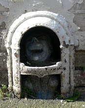
It's actually more to do with the figures on the top of the pillars - or more correctly I suppose the faces. Quite often these faces are those of fairly anonymous classical ladies or fierce-looking blokes with beards or even a cherub or two. Whatever they are they though they do seem to be taken from a set of stock characters or archetypes and not specifically intended to depict any specific and identifiable individual

I've a feeling that these two are slightly out of the ordinary though and that there's a good chance that they depict a couple of well-known characters. The one on the left looks European, has a shaggy moustache and a very strange hat, whilst the one on the right is clean shaven with short curly or wavy hair and looks very much like a Nubian as depicted in old Egyptian paintings. 

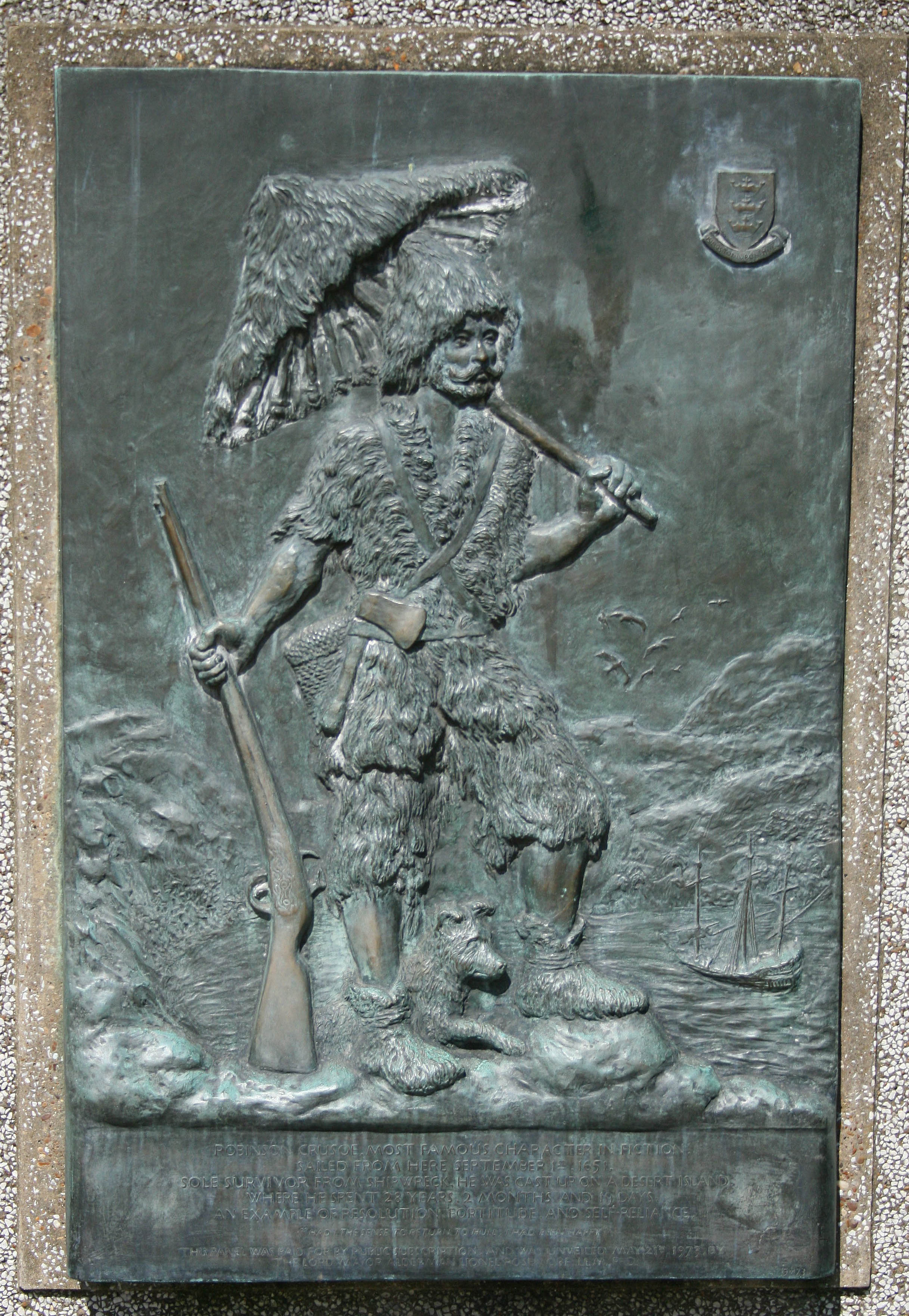
To my eye they look like a pretty good representation of Robinson Crusoe and Friday and I would suggest that the exotic foliage around their heads represents the lush jungle of their island home. It also looks as though the Crusoe figure has been modelled on the classic depiction of him in some of the Victorian editions, like this one taken from the Wiki entry  .

I think this is looking pretty plausible, so running with it for a while I was wondering if there might be an obvious link  between Robinson Crusoe and the name of the building 'Norfolk House'.

Well after copious amounts of dedicated research (hem, hem...) I'm happy to report that there is a link, but it's not all that obvious. Crusoe, it seems, was an unlucky mariner from the very start and after running away from home and boarding a ship from Hull managed to get as far as Cromer off of the Norfolk coast before sinking! He then walked to Yarmouth where he found some aid and assistance and wondered whether the fates were trying to tell him something... Very tenuous then, but luckily not the only one as it turns out.

The other link is to do with the name 'Robinson Crusoe' itself, which when you think about it is quite an odd name. The book itself explains its background
...my father being a foreigner of Bremen...settled first at Hull. He got a good estate by merchandise, and leaving off his trade, lived afterwards at York, from whence he had married my mother, whose relations were named Robinson, a very good family in that country, and from whom I was called Robinson Kreutznaer; but, by that usual corruption of words in England, we are now called - nay we call ourselves and write our name - Crusoe; and so my companions always called me.
This is quite a bit of background colour in order to come up with such an unusual name - why not stick to something like Jack Jones or something? - but it looks as though the author Daniel Defoe may have picked the name up already before he even wrote the book. Defoe enjoyed and wrote about the town of King's Lynn in Norfolk, and as noted on the Literary Norfolk website  'In his A Tour Through the Whole Island of  Great Britain Daniel Defoe was hugely impressed by King's Lynn preferring it, in many ways, to both Norwich and Yarmouth.'  What Defoe might also have noticed would be the graves and gravestones in St Nichols' Chapel, Kings Lynn which happen to contain the earthly remains of several individuals by the name of Robinson Cruso!

Even if there's no real solid link between the figures of Crusoe and Friday (who incidentally, survived to appear in the sequel only to die half way through with three arrows in his chest) and the county of Norfolk, it was still very intriguing to spot what seemed to be a literary reference in a spot of doorway ornamentation. 'Norfolk House' is more than likely a bit of a red-herring - it could just  be that the owner enjoyed a good read!

Wednesday, 17 March 2010

Walkie Round The (Covent) Garden

I have a basic assumption that anything interesting in Central London has probably been photographed numerous times and posted on loads of blogs, but despite that  but I still can't help taking the camera along if there's any chance that I might find myself in a new (for me) area. So a few weeks ago a trip up to town to take in some of the Chinese New Year celebrations turned into an impromptu Faded London session as a couple of interesting items caught my eye.

Almost the first thing that stood out was this Ghost Sign just down Oxford Street and easily visible when you emerge from Tottenham Court Road tube.
 
 It's been revealed by the knocking down of the adjacent building and I'm pretty sure that it's been the topic of posts on various other blogs and websites. I'm also sure that lots of research has been completed to find out  a bit more about Veglio's but, never afraid of being behind the times, I've had a quick go myself to see if I could get an idea of the type of eatery it was. 

One of the few direct references I could find was in  Samuel Butler - A Memoir by Henry Festing Jones. When recalling a friend of Butler's called Thomas Ballard - a decent but unworldly painter who walked the pavements with his pockets full of apples whilst reading books and weaving in and out of other pedestrians with his uncanny ability to avoid collisions - Veglio's gets a passing mention.
"I remember Ballard quite well. I have seen him with a model at Veglio's restaurant, which used to be on the Euston Road, not far from his studio. If, after a day's work, he thought that his model had not had enough to eat lately, he would bring her with him to supper. Appearances might be against him - he did not care."
Ballard was tall, thin with a straggling beard and moustache. He also had poor teeth with several of the front ones missing but although he continually underpriced his work, and was constantly broke as a result, he had a reputation for generosity and of being more than happy to give a needy soul the very shirt off of his back. And posibly of not having a huge amount of luck with the ladies...

All of which suggests that Veglio's Italian restaurant might be acceptable for the impoverished Middle Classes but probably wasn't a landmark London eatery. The Baedeker's Guide had it marked down as 'moderate' which seems about right.

  
 Just off Leicester Square I caught sight of some surviving tile-work that's been hemmed in, chipped about, partially covered and truncated. It's still very attractive though, even if it's major role these days is to provide an anchor for a burglar alarm.
I think most people would agree that life is made all the more interesting by a healthy dollop of whimsy now and then. Not too in your face either, just whimsical enough to catch the eye, pull in the punter and then leave them with a large, metaphorical question mark hanging over their head before the slow realisation sinks in that they've been had. Which this plaque does in spades. It's situated high up above a shop on the approaches to Leicester Square so that even on maximum zoom from the other side of the street the Faded London Box-Brownie was unable to capture it with anything other than a blurred, arm-shaken effort.
My best effort at transcription is as follows:
GREAT DANGEROO FLOOD
This plaque has been placed at the high water mark of one of the worst floods of the En'kymhirian  times. Incredibly after two years at sea on their rafts of asphalt the Tehapchapi, the great road builders of Extrellita [the initial 'K' is not usually written] nearly foundered here at the end. But that first rezhen as the waters receded, the sky cleared, revealing a sign. No new heavens at all, but, for just that one night the stars from the other side of the world and so they called the place New Extrellita the name now given to this realm of Arctic Islands
The big clue is at the bottom of the plaque which records the website kymaericaproject.com and from having a look around on there it looks as though The Great Dageroo Flood is only one of a number of plaques sited around the world recording the history of a culture and civilization whose existence touches our own at various points. Basically it seems to be a fantasy and story-telling based site. So it's organised whimsy on a world-wide scale.

Cricket and Fish & Chips - what could be more evocative of England? I was really surprised to see this around the side of Leicester Square tube station, but it's such a prominent and highly visible part of the building fabric that I'd imagine that the locals are quite blasé about it.

Apparently the station was built in 1906 without the offices above, but it wasn't long before they were added and Wisden moved in. John Wisden himself was long-gone having died in 1884,  but he had a long association with the area having been in business with Fred Lillywhite, a partner who was later to be a competitor and who still has a famous store named after him. They set up "...a tabbaconist cum sporting goods depot off the Haymarket in London, subsequently relocated in Leicester Square"  (Silent Revolutions by Gideon Haigh) but whereas Lillywhites eventually survived as a sporting goods store, Wisden was the winner when it came to the publishing side of things.  
What used to be the doorway and steps up to the offices is now a small shop. Burgers, kebabs, falafals and pizzas may not be quite as English as Fish & Chips though.

I headed off toward Covent Garden down Long Acre and here on the corner of Mercer Street was intrigued to see this sign which looks in suspiciously good condition! The businesses have gone but I wonder if the owners have decided it was better to keep the signage in good condition rather than let it flake off?
  
 Slightly further along I was very taken with these two regal ladies sitting above the entrances to Langley House. The style of ornamentation is described as 'Flemmish Rennaisance' on a Listing Appraisal and from that it seems that a significant section of land in the area is owned by the Mercers Company, as this extract (and the name Mercer Street!) suggests
Elmfield, to the north of Long Acre, was not bought by Henry VIII, but remained in the possession of the Mercers' Company. In 1614 the Mercers granted a 30 years' lease of it to Thomas, Earl of Exeter, who in the following year sold his lease to Sir William Slingsby. The street called Long Acre was laid out at about this time by Slingsby and the Earl of Bedford, the line of the street following approximately the line of the common boundary of their properties. Thenceforth the term Long Acre was frequently applied to the ground on both sides of the street, and in 1650 when the Mercers' ground was surveyed it was referred to as "Elme Close alias Long Acre," and a certain Captain Disher tried to prove that it was part of the property purchased by Henry VIII. From: 'Long Acre', Survey of London: volume 20: St Martin-in-the-Fields, pt III: Trafalgar Square & Neighbourhood (1940), pp. 125-127.
The Worshipful Company of Mercers were basically an association of Merchants dealing mainly with the luxury end of the market and their website has a description of a mysterious figure known as The Mercer's Maiden!
 The Mercers’ Maiden is the symbol and coat of arms of the Company. She first appears on a seal in 1425. Her precise origins are unknown, and there is no written evidence as to why she was chosen as the Company’s emblem.She is often depicted wearing the fashions of any given period because she was not formally granted as a coat of arms until 1911. Over many centuries she has graced letterheads, legal documents, furnishings, and property of the Company. Maiden ‘property marks’, usually crafted out of stone, often adorned the exterior walls of buildings belonging to the Company, and are still common sights in London
So the hunt is on! These two maidens looks as though they could well have triggered a future posting about Mercer Maidens found around the city.


 The next two items are nowhere near as glamorous but they are still of interest in their own way. A while back I had a posting devoted to what I called 'wall braces' but this seemed to spark a vigorous debate on an American architectural site, the outcome of which was that as they did not push things apart as braces do, but pull them together, the correct term should be 'bearing plates'

I won't make that mistake again, so here are a couple of nice hand-made bearing plates!
And Finally, back in Long Acre the signage for another Carriage Manufactory , this time fading away gently in very low-vis yellow paint.
 That was pretty much it for my quick tour. I enjoyed the Wisden sign, decided that I hadn't missed much by not dining at Veglio's, was intrigued by the Dageroo Flood and then found out something new about the Mercer Maidens. Definitely worth taking the camera for. Chinese New Year was fun as well....